Wurdong Heights BESS
Deliverables
8 ground-level views and 2 aerial perspectives
Project turn-around
2.5 weeks
Key challenges
Highly bespoke components still under development.
Tropical Cyclone Kirrily (!)
In January 2024, Akaysha Energy approached us to produce a set of 10 photomontages for their planned large-scale Battery Energy Storage System (BESS), near Wurdong Heights in the Gladstone Region of Queensland.
The images were to be the key component for community consultation and development approval, and as such needed to be both highly realistic and verifiably accurate.
An additional element of urgency came with Tropical Cyclone Kirrily bearing down on the region, threatening to delay a site visit indeterminately.
Geospatial setup and massing model
The initial step in this project involved generating a 3D representation of the site and its surroundings. Utilizing publicly accessible LiDAR and DEM data, we classified, optimised and extracted the project-relevant data.
With our project datum point established we could then incorporate the available client drawings to create a quick massing model.
Since the final design was still a work in progress, we relied on the massing model for exploring and selecting viewpoints.
3d massing model
Site visit and data capture
With the incoming wet weather, we had a short window to get out on site and capture the required info. To expedite the process we elected to engage local contractors:
Photographer for the ground level photography
Drone operator for the aerial photography and higher resolution aerial mapping, to augment the geospatial data we'd already managed to source.
Scene creation
Once the Akaysha engineers had completed the drawings we went to work on creating detailed representations of all project components, including:
BESS equipment* and layout
HV substation, transmission lines & supporting infrastructure
Site layout, auxiliary buildings, access routes and perimeter protection assets
Landscaping including screening vegetation & new site contours according to cut and fill drawings
Production
With the 'bespoke' part of the work behind us we could then move the project through our standard production pipeline to delivery:
Camera matching
Aligning 3D virtual cameras with real-world photo locations using LiDAR point clouds for verification.Lighting and rendering
Ensuring accurate lighting conditions and generating highly realistic images of the proposed development.Compositing
Seamlessly integrating the rendered images into the corresponding viewpoint photographs.
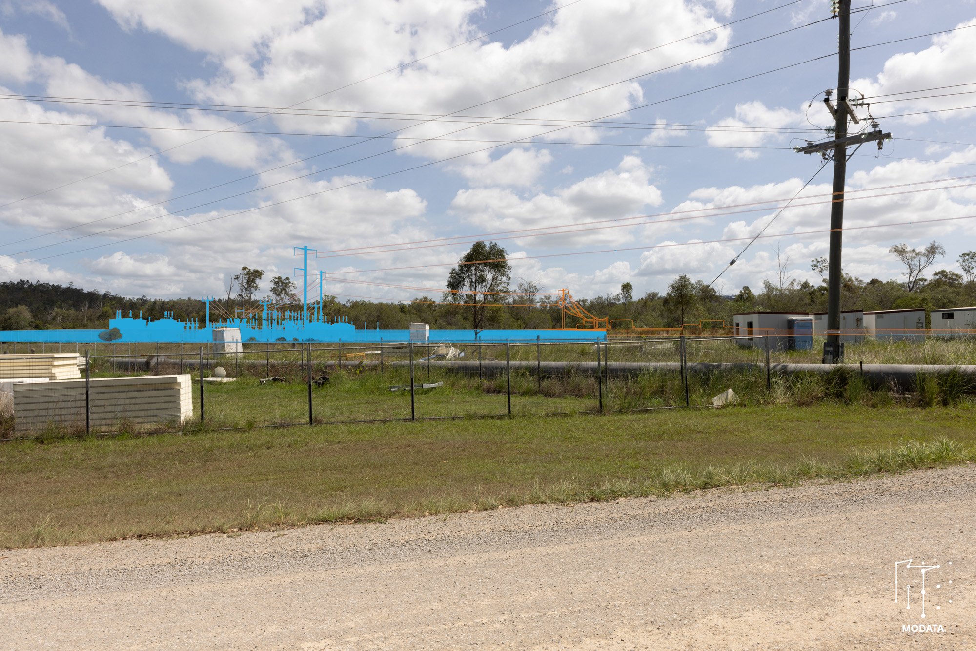
Alignment verifification: LiDAR pointcloud overlaid on photograph
“We were extremely impressed with Modata’s aerial photomontages – they are some of the very best BESS renders we have seen so far. The team were very professional and easy to work with, keeping us involved throughout the process and working with us to achieve the best outcome.
The internal consensus is that Modata’s work is first class and has set a benchmark for other projects!”
Tanzia Matotek - Development Manager, Akaysha Energy


